Interested in the Landforms Of North Korea? Read ahead to learn more about North Korean landforms…
North Korean landforms include diverse elements like mountains and hills, coastlines, rivers and plains. While the mountain ranges surround the country, it is bordered by three seas, which give it an immense stretch of coastline.
Rivers and Seas in North Korean Landforms
Since the North Korean territory is part of the Korean Peninsula, it has two of the largest rivers of the Amnokkang region, the Yalu River and the Tuman-gang, Tumen flowing through it.
Both these rivers originate from the mountain, which is the highest in Korea as well as Manchuria and known as Mount Paektusan with a total height of 2,744 meters above sea level. On the other three sides, the North Korean peninsula is surrounded by three separate seas, which include the South Sea, East Sea and the Yellow Sea.
Mountains in North Korean Landforms
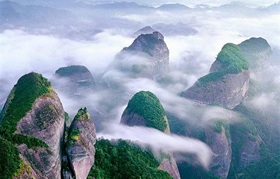
Approximately 70% of the region has a hilly and mountainous terrain. The hills cover most of the south and west side and gradually increase in height while finally reaching the height of the mountains on the east and north sides.
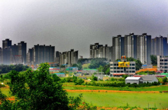
The vast plains and basins along the rivers cover the west and south slopes of the Korean Peninsula but the east slope becomes narrow due to the large mountains running along the coastline of the East Sea.
The mountains are located in the T’aebaeksan range, which runs parallel to the east coast from north to south. The drainage basins of both the Han-gang River and Kumgang River are located on the east of this range.
It goes on to extend into North Korea by joining the Nangnimsan mountain range and as a result makes up the drainage divide that separates the eastern and western slopes in the peninsula while making up the backbone of the region in geomorphologic and geological terms.
The other important mountain range that divides the north and south region of the peninsula is known as the Sobaeksan, which ends in one of the huge mountain peaks known as Mount Chirisan, which is 1,915 meters above sea level.
Roof of Korea Plateau
The ‘Roof of Korea’ is the title given to the northwestern plateau known as the Kaema Plateau. It is located approximately 1500 m above sea level. Despite its proximity to the unstable geological region of Japan, the North Korean Peninsula is fairly stable in terms of geology and does not have any active volcanoes or earthquakes.
Rivers and Plains in North Korean Landforms
Majority of the rivers that make up the landforms in North Korea drain into the Yellow Sea, while the other rivers flow into the South Sea, which drains the southern and western slopes of the peninsula. There are many streams that spread all over the Korean landscape and some of them run more than 400 km. The river discharge is known to fluctuate during the summer monsoon as the rivers overflow and flood the plains.
For the remainder of the year the rivers are relatively dry. Every two or three years the region is hit on the southern side with typhoons that result in heavy rain during the late summer time and early autumn season. The narrow floodplains are especially prominent along the lower reaches of the rivers and are part of the largest rice producing landforms in North Korea.