Want to know more about the geography of Nepal? The following article should help give you some good facts and figures.
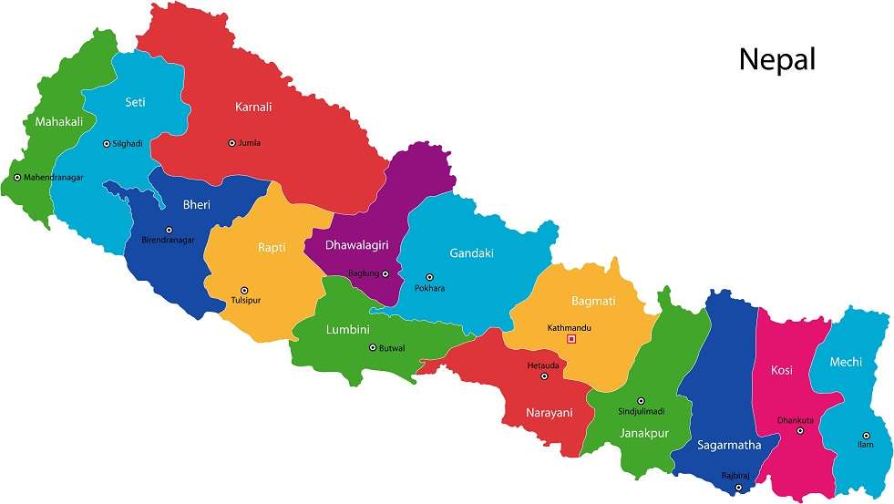
Nepal has a very interesting geography as it is a relatively small country which is sandwiched between the respectively larger countries of India and the Tibetan Autonomous region of China. It occupies an area of just over 145,000 square kilometeres. There is no coast in Nepal, as it shares three quarters of its borders with India (south, east and west) and the remaining northern border with China.
The border geography for Nepal means that it is fairly dependant on India for access to the sea and for receiving imports into the country.
The geography of Nepal is very mountainous and as such, it is host to the Himalayas in the north of the country which contains Mount Everest; the tallest mountain in the world. Mount Everest is just over 29,000 feet in height. The majority of the other Himalayan peaks exceed 8,000 meters in height. The most famous of these mountains include Kanchenjunga (8,598 meters) and Dhaulagiri (8,137 meters).
The lowest geographical point in Nepal is in the Jhapa region and measures 70 meters above sea level.
In addition to the Himalayas, the geography in Nepal is also host to two other physiographic regions known as the ‘Hills’ and the ‘Terai’. These zones are determined by the relationship of the land to sea level. Whilst the Himalayas makes up approximately 15% of Nepal, the Hills makes up approximately 65% and the Terai makes up approximately 18%.
Unfortunately the Hills have been subject to an increasing number of environmental disasters which are due in likelihood to deforestation and intensive farming. Kathmandu is situated in the Hills.
The geography of the Terai makes it excellent fertile land for farming. This zone is host to marshes, forests and wildlife such as the rhino and crocodiles.
Due to the diverse land geography within these zones, the weather and climatic conditions are clearly very different.


