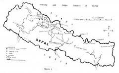
Want to know more about the U502 topographic maps relating to Nepal? Then read on!
If you are looking for a highly accurate topographic map of Nepal then the U502 series of maps provide you with excellent quality information.
What are the U502 Series of Maps?
The U502 Series of Maps were first printed during the late 1950s and the early 1960s by the US Army Map Service.
The U502 Series of Maps generally covers the entire Indian Subcontinent and as such Nepal. Specifically the series covers the Himalayas, Karakoram, Nepal and Sikkim. There are 271 maps in the U502 series.
The U502 Maps are topographic maps with contours at 500 foot intervals. They are fairly detailed and include key villages / towns etc. within Nepal. However, smaller villages in Nepal – or new settlements and new roads will not be seen due to the date at which they were last revised (1962).
Each map in the U502 Nepal range depicts its accuracy using a reliability indicator.
What is the source of the U502 Series?
The U502 Series used the Survey of India maps as a key source of information.
Are there copyrights on the downloadable U502 Nepal maps?
No, there are no copy right restrictions on the vast majority of U502 Nepal maps. However, since the maps have been scanned by the University of Texas Libraries, then courtesy dictates that they should be referenced as the source of any material that you may produce of the back of them.
Please note that you are unable to use the U502 Nepal maps in the production of merchandise or related items.
Do the US Army Map Service still produce maps, and if so, when were the U502 Nepal maps last updated?
No, the US Army Map Service no longer exists. It was reorganised into the Defense Mapping Agency. The last revision of the U502 Nepal maps was in 1962.


