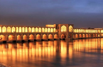
Tehran sits at the foot of the Alborz mountain range in northern Iran, spread across 730 square kilometres at altitudes ranging from 900 metres in the south to over 1,800 metres in the northern districts. Roughly 9 million people live inside the city limits and 15 million in the greater metropolitan area, making Tehran the most populous city in Iran and the second-largest in Western Asia after Istanbul. The city became the capital of Persia in 1796 under the Qajar dynasty and has remained the seat of government through the Pahlavi monarchy, the 1979 Islamic Revolution, and the current Islamic Republic. Tehran’s role as the political, economic, academic, and cultural centre of Iran has produced 50 universities, 20 major museums, over 200 art galleries, and a population mix that spans traditional bazaar merchants, conservative religious families, and a large secular middle class.
This guide walks through Tehran’s geography and population, pre-capital history and the Qajar-era foundation, the modern districts from Darbande in the north to Rey in the south, major landmarks including the Golestan Palace and the Azadi Tower, Alborz mountain access for skiing and hiking, museums and cultural venues, food and bazaar culture, climate, and practical travel information.
Geography and Population
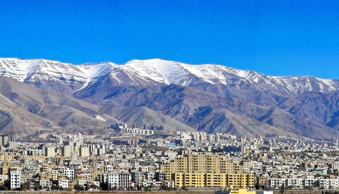
Tehran Province covers roughly 18,814 square kilometres, with the city itself occupying 730 square kilometres of the provincial territory. The Alborz mountain range to the north forms a natural barrier between Tehran and the Caspian Sea, with Mount Damavand (5,609 metres, the highest peak in Iran and a dormant volcano) visible from the city on clear days about 70 kilometres northeast of the centre.
Tehran’s elevation climbs from south to north. The southern districts sit around 900-1,100 metres; the northern residential districts of Tajrish, Niavaran, and Darband reach 1,700-1,800 metres. This 800-metre vertical range produces noticeable climate differences across the city: northern neighbourhoods get regular winter snow while southern districts remain snow-free, and summer temperatures in the north run 5-7 degrees cooler than in the south.
The city is divided into 22 municipal districts (manteqeh), each with its own administrative centre and local councils. Districts 1-3 in the north are the wealthiest and most internationally oriented. Districts 12 and 6 hold the traditional bazaar and central government areas. Districts 15-20 in the south tend to be working-class and conservative. The population mix reflects Iran’s ethnic diversity: ethnic Persians form the majority, but significant Azeri, Kurdish, Armenian, Assyrian, and Afghan communities live throughout the city.
Pre-Capital History
The Tehran area has been inhabited for at least 7,000 years, based on archaeological evidence from excavations at Cheshmeh Ali and neighbouring sites. The settlement of Rey (modern Shahr-e Rey in southern Tehran) was a major Zoroastrian religious centre in the Sassanid period, capital of the Medes kingdom around 1,000 BCE, and a significant Silk Road trading point through the early Islamic period. Mongol armies destroyed Rey in 1220, and the small neighbouring village of Tehran gradually absorbed the survivors and became the regional centre.
Through the 15th and 16th centuries Tehran remained a small market town of roughly 5,000 people known mainly for its fruit orchards (Tehran pomegranates were celebrated in Safavid poetry). Shah Tahmasp I of the Safavid dynasty, who reigned 1524-1576, took a liking to the Tehran valley and built fortifications, converting the village into a walled town. The Safavid improvements established the urban infrastructure that later rulers would expand.
The Afsharid and Zand dynasties of the 18th century used Tehran as a secondary administrative centre while the capital moved between Isfahan, Mashhad, and Shiraz. Karim Khan Zand briefly considered making Tehran the capital but settled on Shiraz.
Tehran as Qajar Capital (1796-1925)
Agha Mohammad Khan Qajar declared Tehran the capital of Persia in 1796, shortly after his coronation. The choice reflected strategic calculations: Tehran sat closer to the Qajar homeland in northern Iran than rival capitals, had defensible terrain backed by the Alborz mountains, and was small enough to be reshaped in the ruling family’s image without entrenched urban elites to negotiate with.
Over 129 years of Qajar rule, Tehran expanded from a walled town of 15,000 to an unwalled city of nearly 200,000. Key Qajar-era developments included:
- The Golestan Palace complex, expanded and decorated across several decades as the main royal residence
- The Grand Bazaar, which grew to over 10 kilometres of covered passages with thousands of shops
- Dar ul-Funun, Iran’s first modern university, founded 1851 by reformist chancellor Amir Kabir
- Western-style ministries, administrative buildings, and telegraph infrastructure
- The Sepahsalar (now Shahid Motahhari) Mosque with traditional tile work
- The first electric lighting in central government buildings by the 1890s
The 1906 Constitutional Revolution, which established Iran’s first parliament (Majlis), centred on Tehran. The old walls were demolished in the 1930s under Reza Shah Pahlavi, and the moat became the modern Enghelab (Revolution) Avenue.
Pahlavi-Era Modernisation (1925-1979)
Reza Shah Pahlavi and his son Mohammad Reza Shah transformed Tehran from a Qajar-era capital of 200,000 into a modern city of 4.5 million by 1979. Major projects during this period:
- The Azadi Tower (originally Shahyad Tower), built 1971 to mark the 2,500th anniversary of the Persian Empire. 45 metres tall, in a distinctive Y-shaped design by architect Hossein Amanat, the tower sits at the western gateway from the airport.
- The Tehran Metro, planned from the 1960s though the first line only opened in 1999
- University of Tehran, founded 1934 and expanded several times through the Pahlavi era
- The Niavaran and Saadabad palace complexes in the northern suburbs
- Major road networks including Vali Asr Street, running 17 kilometres south-to-north through the heart of the city
- Industrial and residential suburbs, including purpose-built districts like Ekbatan for professional and military housing
The Pahlavi period also produced much of the city’s cultural infrastructure: the Tehran Museum of Contemporary Art (holding a major Western modern art collection unusual for any museum outside Europe and North America), the National Museum of Iran, the Carpet Museum, and the Reza Abbasi Museum of Islamic art.
Post-1979 Tehran
The 1979 Islamic Revolution transformed Tehran’s political character without halting its physical expansion. Population grew from 4.5 million in 1979 to over 9 million by 2020. Post-revolutionary developments include:
- Major mosque construction including the Imam Khomeini Mausoleum south of the city, completed 2017
- Expansion of the Tehran Metro to seven lines covering 240+ kilometres
- Milad Tower, completed 2008, 435 metres tall, ranking among the ten tallest free-standing towers in the world
- Nature Bridge (Tabiat Bridge), an architecturally celebrated pedestrian bridge completed 2014
- New suburban developments including Pardis, Parand, and Andisheh satellite cities
- Major new art spaces including the Iranian Artists Forum and numerous private galleries
Economic sanctions since 2018 have slowed some infrastructure projects, but Tehran remains a major construction and real-estate market. The city hosts roughly 20 percent of Iran’s GDP despite holding about 12 percent of the national population.
Major Landmarks and Sights
Central Tehran holds several landmark sites worth visitor attention:
- Golestan Palace: the oldest surviving royal complex in Tehran, with 17 buildings spanning Qajar, Pahlavi, and pre-Qajar architectural periods. UNESCO World Heritage Site since 2013. The Marble Throne Hall, Hall of Mirrors, and the Shams-ol-Emareh building are highlights.
- National Museum of Iran (Muze-ye Iran-e Bastan): archaeological collection spanning 7,000 years from Paleolithic through Sassanid periods. The Achaemenid displays from Persepolis and the Susa tablet collection are particularly important.
- Treasury of National Jewels: held at the Central Bank building, housing imperial regalia including the Peacock Throne and the Darya-i-Noor diamond
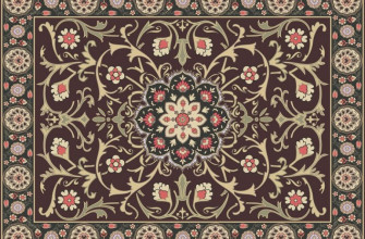
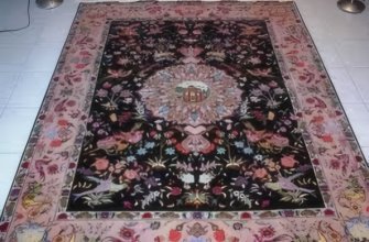
- Carpet Museum of Iran: 135 Persian carpets from across the country’s weaving regions, providing context for Persian carpet tradition broadly
- Azadi Tower and Azadi Square: the western gateway monument and surrounding plaza
- Milad Tower: 435-metre telecommunications tower with observation deck, restaurants, and city views
- Grand Bazaar (Bazaar-e Bozorg): 10+ kilometres of covered market, traditional trading centre of Iran for centuries
- Tehran Museum of Contemporary Art (TMOCA): Western modern art including works by Picasso, Warhol, Pollock, Rothko, and Monet held in storage during the revolution and periodically displayed
- Saadabad Palace Complex: former Pahlavi summer residence in northern Tehran, now a museum complex
- Niavaran Palace Complex: another former Pahlavi residence, smaller and more intimate than Saadabad
Most sites charge entry fees in Iranian rial. The National Museum and Golestan Palace are the core archaeological stops; TMOCA draws contemporary art enthusiasts in particular.
Mount Tochal and Alborz Access
The Alborz range immediately north of Tehran makes the city unusual among world capitals for its mountain access. Three main destinations draw visitors:
- Mount Tochal: 3,960 metres, reached by the Tochal Telecabin cable car from northern Tehran. The cable car runs 7.5 kilometres to a mid-station with ski runs and on to the summit station. Winter skiing season runs December through March.
- Darband and Darakeh: villages at the foot of the mountains with traditional teahouses along mountain streams. Popular weekend hiking from spring through autumn.
- Shemshak and Dizin ski resorts: 60-80 kilometres north of central Tehran. Dizin is Iran’s largest ski area with 9 cable cars and runs at up to 3,600 metres elevation.
The mountain access means Tehran residents can ski in winter mornings and swim in the Caspian Sea (100 kilometres northeast) in summer afternoons on the same weekend. Few other national capitals offer that range of terrain within 2-3 hours of the centre.
Food and Bazaar Culture
Tehran cuisine blends Persian regional traditions with Azeri, Armenian, and Afghan influences. Classic dishes visitors encounter:
- Chelow kabab: Iran’s national dish. Saffron rice with grilled meat (koobideh minced lamb, barg sliced fillet, or joojeh chicken)
- Ghormeh sabzi: slow-cooked herb stew with lamb, kidney beans, and dried limes, served over rice
- Fesenjan: walnut and pomegranate stew with chicken or duck, a North Iranian speciality
- Dizi (abgoosht): traditional stew of lamb, chickpeas, and potato, eaten with bread
- Kashke bademjan: roasted aubergine dip with kashk (whey), served as a starter
- Khoresht aloo morgh: chicken stew with dried prunes
- Persian ice cream (bastani) with saffron and rosewater, often served with faloodeh (rice noodle dessert)
The Grand Bazaar (Bazaar-e Bozorg) remains the heart of traditional trade with dedicated sections for carpets, jewellery, spices, and fabrics. Tajrish Bazaar in the north and the Friday Bazaar at Parvaneh are smaller but more accessible. For broader context on Iranian food traditions, see our food in Iran overview.
Climate and Best Time to Visit
Tehran has a continental climate with hot dry summers and cold winters. The city lies in a rain shadow of the Alborz, giving it less precipitation than would be expected at this latitude.
- Spring (March-May): 12-22 degrees Celsius, pleasant weather, Nowruz (Persian New Year, March 21) brings a 2-week festival period
- Summer (June-August): 28-38 degrees, dry and dusty, many families move to Caspian Sea coast or Alborz foothills
- Autumn (September-November): 15-28 degrees, arguably the best visitor season with moderate temperatures and colourful mountain views
- Winter (December-February): 2-12 degrees, occasional snow (particularly in northern districts), ski season active in the nearby Alborz
Pollution peaks in winter during temperature inversions. Ramadan dates shift annually and affect restaurant hours, though hotels continue normal service for non-Muslim visitors.
Transport and Practical Information
Tehran’s airport setup splits into two facilities:
- Imam Khomeini International Airport (IKA): 40 kilometres southwest, handles most international flights
- Mehrabad Airport (THR): 10 kilometres west, handles domestic flights and some regional international routes
Ground transport:
- Tehran Metro: 7 lines covering 240 kilometres, fares roughly 0.10-0.20 euros per trip, extensive coverage across central districts
- Bus Rapid Transit (BRT): 10 lines running on dedicated lanes, complementing Metro service
- Snapp and Tapsi ride-hailing apps (similar to Uber): dominant for taxi service, prices half or less of traditional taxis
- Traditional taxis: shared and private, often unmetered, negotiate fare before starting
- Rental cars: available but challenging for non-Iranians due to traffic intensity and unique driving culture
International sanctions affect travel practicalities. Western credit and debit cards do not work in Iran; visitors must bring cash (US dollars or euros) and exchange at official banks or licensed bureaux. Mobile internet works on local SIM cards (Hamrah-e-Aval, Irancell, or Rightel); Western carriers’ roaming is unreliable.
Frequently Asked Questions
What is the capital of Iran?
Tehran has been the capital of Iran (formerly Persia) since 1796, when Agha Mohammad Khan Qajar made it the seat of his new dynasty. It has remained capital through the Qajar and Pahlavi monarchies and the current Islamic Republic.
How many people live in Tehran?
Roughly 9 million people live within Tehran city limits and around 15 million in the greater metropolitan area. This makes Tehran the most populous city in Iran and the second-largest in Western Asia after Istanbul.
Is Tehran safe for tourists?
Tehran is generally safe for tourists, with violent crime against visitors rare. Standard urban precautions against pickpocketing apply in the Grand Bazaar and crowded Metro stations. Political sensitivities mean tourists should avoid photographing government buildings and should check current UK FCDO, US State Department, or equivalent advisories before visiting.
What is the best time to visit Tehran?
April-May and September-November offer the most comfortable weather (12-28 degrees Celsius) and clearer air. Nowruz (Persian New Year, 21 March) is culturally significant but many businesses close. Summer heat and winter pollution make June-August and December-February less pleasant.
Can I ski near Tehran?
Yes. Mount Tochal sits directly north of the city with ski lifts reachable by cable car. Larger ski resorts at Shemshak and Dizin lie 60-80 kilometres north, with runs at up to 3,600 metres. Ski season runs December through March.
Do Western credit cards work in Tehran?
No. International sanctions block Western credit and debit cards from working in Iran. Visitors must bring cash (US dollars or euros) and exchange at official banks, licensed currency exchanges, or hotels. Iranian banks issue local cards that work within the country.
What is the Azadi Tower?
Azadi Tower is a 45-metre Y-shaped monument at the western entrance to Tehran, completed in 1971 to mark the 2,500th anniversary of the Persian Empire. Designed by architect Hossein Amanat, it combines Achaemenid and Islamic architectural motifs. The tower’s original name was Shahyad (King’s Memorial) before being renamed Azadi (Freedom) after the 1979 revolution.
Sources and Further Reading
- Tehran: A Revolutionary City – Maziar Behrooz, American Historical Review
- History of Iran: From the Earliest Times to the Present – Kamran Matin, I.B. Tauris
- The Archaeology of Tehran’s Ancient Rey – Iran Heritage Foundation
- Tehran Municipal Information – tehran.ir
- Iran Statistical Centre population data – amar.org.ir
- UNESCO Golestan Palace World Heritage documentation – whc.unesco.org