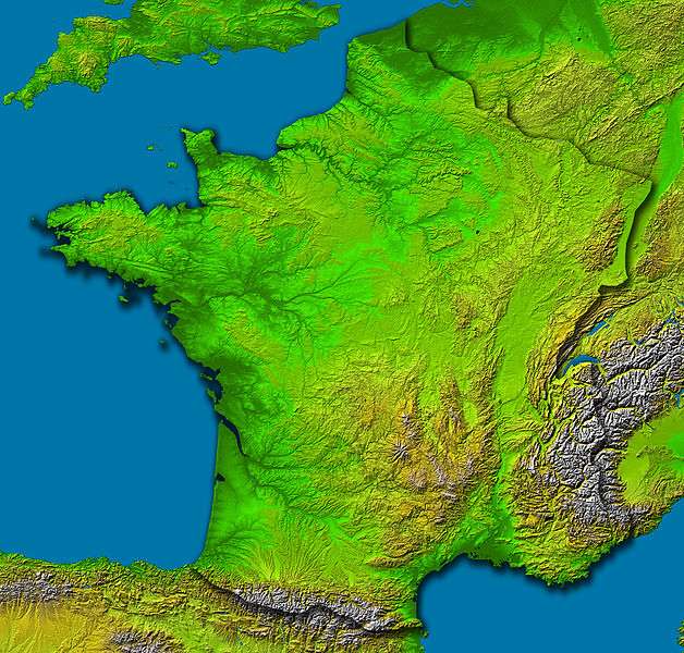
France covers around 551,000 square kilometres of mainland Europe, the largest country in the European Union and roughly the shape of a hexagon, which is why the French call their own country l’Hexagone. It borders eight countries, faces three seas, and runs from the high Alps in the south-east to the flat northern plains, packing an unusual range of landscapes, climates and wildlife into one temperate country. This overview sets out the shape, relief, rivers, climate, environment, regions, overseas reach and human geography of France, and links to the deeper guides on its landforms and mountains.
The shape and borders of France
The hexagon has six broad sides, three of land and three of sea. The land borders run with Belgium and Luxembourg in the north-east, Germany and Switzerland in the east, Italy and the micro-state of Monaco in the south-east, and Spain and tiny Andorra in the south-west.
Several of those borders are mountain walls: the Pyrenees seal the frontier with Spain, the Alps and the Jura the frontiers with Italy and Switzerland. The north-eastern border, by contrast, is open and flat, the route by which armies have crossed into France throughout its history. The three sea sides face the English Channel in the north, the Atlantic in the west, and the Mediterranean in the south, giving France both an Atlantic and a Mediterranean character that shapes everything from climate to cuisine.
Relief: mountains, plateaux and plains
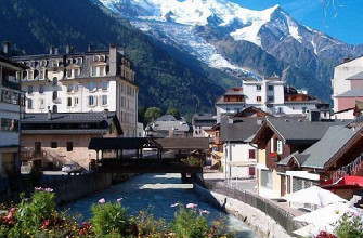
France slopes broadly from high ground in the south-east to lowlands in the north and west. The highest land is the Alps, topped by Mont Blanc at 4,807 metres, the highest summit in Western Europe, with the Pyrenees forming a second high wall in the south-west.
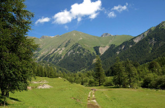
Between and around them sit older, worn uplands: the volcanic Massif Central in the centre, the granite of Brittany, and the Vosges and Jura in the east. The Paris Basin and the Aquitaine Basin spread the great lowland plains across the north and south-west, and more than half of France lies below 200 metres. The relief is the work of two mountain-building eras hundreds of millions of years apart, the ancient Variscan and the recent Alpine, and our guide to the major landforms of France explains each region and that geology in full, while the mountains of France guide covers the ranges as skiing and hiking country.
Rivers, canals and lakes
Four main river systems drain the country. The Loire, at around 1,012 kilometres the longest, runs from the Massif Central to the Atlantic. The Seine flows through Paris to the Channel, the Garonne drains the south-west into the Gironde, the largest estuary in Western Europe, and the Rhone carries the most water, running from Lake Geneva south to the Mediterranean. The Rhine forms part of the eastern border before turning north out of France.
The rivers were long knitted together by canals. The Canal du Midi, a UNESCO World Heritage site finished in the seventeenth century, links the Garonne to the Mediterranean and so joins the two seas across the south, an engineering feat that reshaped trade before the railways. France also holds the largest natural lakes in the Alps, Lake Geneva shared with Switzerland and the lakes of Bourget and Annecy, glacial basins left by the ice age and now resort waters.
Climate and the winds
France spans four broad climates. The west is oceanic, mild and wet off the Atlantic; the east and centre are more continental, with colder winters and hotter summers; the south enjoys a dry, warm Mediterranean climate; and the mountains have their own alpine climate of long snowy winters.
Strong regional winds are part of the pattern. The Rhone valley funnels the mistral, a cold, dry wind that blows down toward the Mediterranean and clears the southern sky for days at a time, while the tramontane does the same along the Languedoc coast. That variety underpins the country’s farming and its regions, from the dairy and apple country of Normandy and the wheat plains around Paris to the vineyards of Bordeaux, Burgundy and Champagne and the olive groves and lavender of Provence.
The natural environment
For a developed country, France keeps a lot of room for nature. Forest covers around a third of the land and has been slowly expanding, from the planted maritime pines of the Landes, the largest such forest in Europe, to the oak and beech of the interior.
The country protects its wildest country in a network of national and regional parks, from the high-Alpine Vanoise and Ecrins to the wetlands of the Camargue, covered in our overview of the national and regional parks of France. Wildlife has rebounded in places: ibex and chamois hold the high Alps, wolves have returned from Italy and spread across the mountains, a small population of brown bears survives in the Pyrenees, and the Camargue keeps its wild horses, black bulls and flamingos. The Gorges du Tarn and the southern cliffs carry France’s largest population of griffon vultures, reintroduced after they died out.
Natural hazards
The same geography brings its risks, and they differ by region. The Mediterranean south faces summer wildfires and sudden autumn flash floods, the cevenol episodes, when warm sea air dumps months of rain in a day. The Alps and Pyrenees carry avalanche and mountain-flood risk in winter and spring. The Atlantic coast takes the brunt of winter storms, such as the one that flooded low-lying Vendee in recent years, while seismic risk is real but moderate, highest near the Alps and the Pyrenees. France is, on the whole, a geologically stable country with no active volcanoes on the mainland.
The regions of France
Mainland France is split into thirteen administrative regions, and their boundaries broadly follow the physical geography and the old historic provinces.
- The north and west: maritime Brittany on its granite peninsula, the dairy and orchard country of Normandy, the open wheat plains of the Hauts-de-France, and the Paris region of Ile-de-France.
- The east: the vineyards and forests of Grand Est along the Rhine, and the mountains and lakes of Bourgogne-Franche-Comte toward the Jura.
- The centre and south-west: the chateau valley of Centre-Val de Loire, the Atlantic wine country of Nouvelle-Aquitaine around Bordeaux, and the varied Occitanie reaching from the Pyrenees to the Mediterranean.
- The south-east: Auvergne-Rhone-Alpes spanning volcanoes and the high Alps, sun-baked Provence-Alpes-Cote d’Azur on the Mediterranean, and Corsica, the mountainous Mediterranean island.
Each region blends a distinct landscape, cuisine and, often, a regional language or dialect, so the geography of France is also the map of its deep and enduring regional identities.
France beyond the hexagon
French geography does not stop at Europe. A scatter of overseas territories, the legacy of empire, makes France a presence on almost every ocean and gives it the second-largest maritime exclusive economic zone in the world, behind only the United States.
- The Caribbean and Atlantic: the islands of Guadeloupe and Martinique, and French Guiana on the South American mainland, where the Amazon rainforest meets the European space launch site at Kourou.
- The Indian Ocean: Reunion, with its very active volcano the Piton de la Fournaise and the older peak of Piton des Neiges at 3,069 metres, the highest point of the overseas territories, and Mayotte off East Africa.
- The Pacific: French Polynesia, including Tahiti and Bora Bora, and New Caledonia with its vast lagoon, a UNESCO World Heritage site.
These territories spread French time zones across the globe and add tropical, equatorial and volcanic landscapes to the temperate geography of the mainland.
Population, cities and land use
France is home to around 68 million people, spread unevenly across the hexagon. Paris and its surrounding Ile-de-France hold roughly a fifth of the population, far ahead of the next cities, Marseille on the Mediterranean, Lyon at the meeting of the Rhone and Saone, then Toulouse, Nice, Nantes and Strasbourg.
Geographers speak of a diagonal of emptiness, a band of thinly populated rural country running from the north-east to the south-west, set against the crowded coasts, the Paris region and the Rhone corridor. Away from the cities France remains one of Europe’s great farming nations, with more than half its land in agriculture, from the cereal plains of the Paris Basin to the southern vineyards and the cattle pastures of the wetter west. The mountains and the coasts carry much of the tourism that makes France the most visited country on earth.
Frequently Asked Questions
How big is France?
Mainland France covers around 551,000 square kilometres, the largest country in the European Union. With its overseas territories it is larger still, and its roughly hexagonal shape gives it the nickname l’Hexagone. About 68 million people live there.
What countries border France?
France borders eight countries: Belgium and Luxembourg in the north-east, Germany and Switzerland in the east, Italy and the principality of Monaco in the south-east, and Spain and Andorra in the south-west. It also has three sea coasts, on the Channel, the Atlantic and the Mediterranean.
What is the geography of France like?
France ranges from the high Alps and Pyrenees in the south to the lowland Paris and Aquitaine basins in the north and west, with the older Massif Central, Brittany, Vosges and Jura uplands in between and around 5,500 kilometres of coastline on three seas. Four major rivers, the Loire, Seine, Garonne and Rhone, drain the country, and its climate ranges from oceanic to Mediterranean to alpine.
What are the main rivers of France?
The four main rivers are the Loire, the longest at around 1,012 kilometres, the Seine through Paris, the Garonne in the south-west, and the Rhone, which carries the most water from Lake Geneva to the Mediterranean. The Rhine forms part of the eastern border.
What is the climate of France?
France has four broad climates: oceanic and mild in the west, continental with colder winters in the east and centre, hot and dry Mediterranean in the south, and alpine in the mountains. Regional winds such as the mistral down the Rhone valley are a marked feature of the south.
Sources and Further Reading
- Institut national de l’information geographique et forestiere (IGN)
- INSEE, French national statistics
- Geoportail, the national geographic portal
- BRGM, French Geological Survey