The most recent Pavillon Bleu palmares lists 112 sites across Provence-Alpes-Cote d’Azur, putting the region second nationally for sustainable bathing certification behind Occitanie with 120 sites. Within that bracket, 51 Var plages and 37 Alpes-Maritimes sites carry the label, while Nice keeps seven of its certified beaches and Saint-Tropez sits outside the index entirely. France runs roughly 580 kilometres of coastline between Menton and Cassis under the Cote d’Azur name, and the 1986 Loi Littoral forces every commune to reserve at least 80 percent of its beach length for free public access. This guide maps the certified sites by city, decodes how Pampelonne’s 19 concessions actually operate, explains why Nice is pebbles and Cannes is sand, and gives the practical timing French families use rather than the high-season cliches in English booking aggregators.
What the Cote d’Azur actually covers
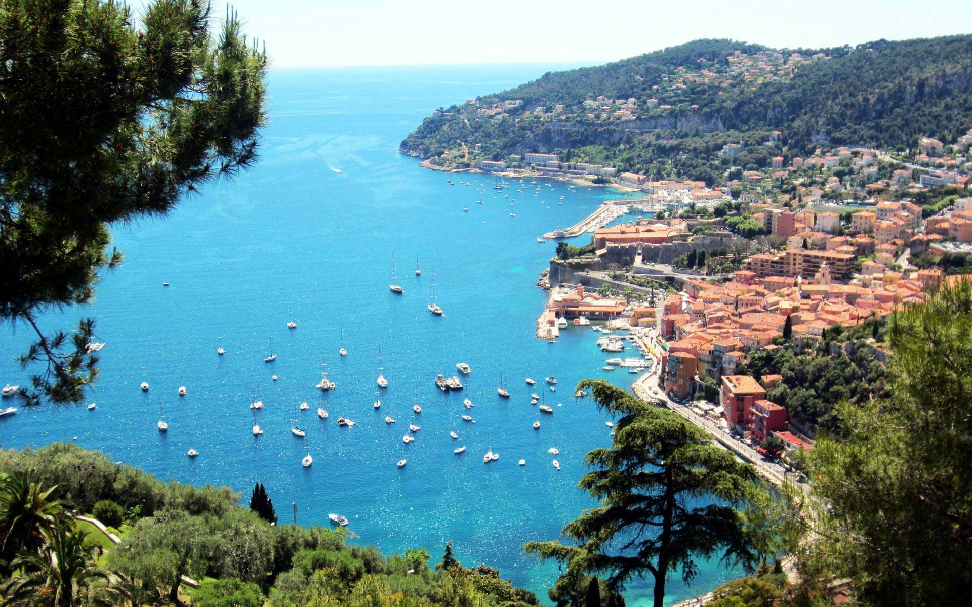
The Cote d’Azur runs west from the Italian border at Menton through Monaco, Roquebrune-Cap-Martin, Nice, Antibes, Cannes, Saint-Raphael, Sainte-Maxime, Saint-Tropez, Hyeres, Toulon, La Ciotat, and Cassis. The administrative break is the limit between PACA and Italy at the east and the limit between Bouches-du-Rhone and Var at the west, which puts roughly 580 kilometres of coastline inside the name. Tourism boards mark the border slightly differently. Some include Monaco even though it is a separate state, others stop the Cote d’Azur at Cap d’Antibes and call the western strip Provence maritime.
The Sentier du Littoral, established by the 1986 Loi Littoral, runs almost the full length as a marked coastal walking path. Most beaches sit within walking distance of one of its sections, which is how French families string together a multi-beach day without driving. The path passes the Tachou cave site at Roquebrune-Cap-Martin, the Terra Amata prehistoric settlement near Nice harbour, the Phare de Cap Camarat above the Saint-Tropez peninsula, and the Esterel red cliffs at Agay.
Geographically the coast splits into three substrates. The eastern stretch from Menton to Cap d’Antibes runs on glacial moraine and Paillon delta debris, which produces galets, the smooth river pebbles French speakers use as the standard beach term. The middle stretch from Cannes to Saint-Raphael runs along Esterel volcanic sandstone, which weathers into fine sand and red porphyry pebbles. The southern stretch around the Saint-Tropez peninsula runs along Mauros granite, which feeds the long fine-sand strands of Pampelonne. For a broader picture of French coastal geology, see our overview of the major landforms in France.
Pavillon Bleu palmares across the Riviera
Pavillon Bleu is a sustainable tourism label run by the French branch of Teragir under the FEE international framework. The certification assesses 49 standards covering bathing water quality, port water quality, waste management, accessibility for people with reduced mobility, and biodiversity preservation. Communes apply each spring for an annual renewal, and the national jury publishes its results in mid-May.
The most recent national palmares confirmed 485 sites in France, broken into 384 beaches, 100 pleasure ports, and one labelled catamaran. PACA placed second nationally with 112 sites.
| Region (top 3) | Total sites | Beaches | Ports |
|---|---|---|---|
| Occitanie | 120 | 102 | 18 |
| Provence-Alpes-Cote d’Azur | 112 | 85 | 27 |
| Nouvelle-Aquitaine | 52 | 48 | 4 |
Inside PACA the two coastal departments dominate. Var carries 51 plages, down by eight sites compared to the prior round. Alpes-Maritimes carries 37 sites, up by two. Bouches-du-Rhone and the inland waterway departments make up the rest. New entrants this round include Plage Peno at Carqueiranne on the Var coast and the Vieux Port de Golfe Juan on the Alpes-Maritimes side.
A site can hold the label one year and lose it the next. Nice lost Blue Beach this round, which also operated an on-site restaurant, while keeping its other seven. Saint-Tropez sits outside the index entirely, which surprises first-time visitors who assume the most famous beach name on the coast must be certified. The label depends on commune application and infrastructure investment, not beach fame.
Nice and the seven Pavillon Bleu beaches
Nice runs about seven kilometres of pebble beach along the Promenade des Anglais from the airport approach to the Old Town. Most stretches are public with free access, separated by private concessions every 200 metres. The geology is glacial moraine deposited by the Paillon and Var rivers, which is why every Nice beach is galets rather than sand.
The seven plages that kept Pavillon Bleu certification this round:
- Castel: easternmost public beach below the Colline du Chateau, smaller stones, lifeguard in season
- Galion: between Old Town and the airport approach, mixed public-private with restaurant access
- Forum: central Promenade stretch, full lifeguard service, accessible boardwalk for reduced-mobility users
- Poincare: family-oriented section near Boulevard Carnot, paddle craft hire on the public side
- Bambou: private-restaurant beach that still qualifies on water quality and accessibility audits
- Sainte-Helene: westward of the city centre, broader pebble strip, less crowded outside July-August
- Carras: closest to the airport, often the last free pebble strip before charter check-in
Blue Beach lost its certification this round. The lifeguard service still operates and the beach restaurant still opens, but the city’s audit failed on either water criteria or infrastructure standards. The Mairie has not published the precise failure category, which is normal practice when a beach is expected to reapply the following year.
Cannes and the Antibes sand belt
Cannes runs sand because the coastline sits west of the Esterel massif, whose volcanic sandstone weathers into a fine red-tinged sand. La Croisette is the headline beach, two kilometres of seafront broken into 32 separate beach concessions plus a free public stretch in the middle. The film festival in May closes the central section for press setup, which makes the western Croisette and the public stretches at La Bocca the more usable options that fortnight.
Beyond Cannes the sand belt continues east through Juan-les-Pins, around Cap d’Antibes, and along the Garoupe peninsula. Cap d’Antibes carries a string of small natural coves, most of them free with footpath access from the Sentier du Littoral. Plage de la Garoupe on the eastern side of the cape is the headline cove, around 100 metres of fine sand under the lighthouse hill, with a free public section and three concessions.
Antibes itself runs Plage de la Salis south of the old town and Plage du Ponteil between the marina and the Picasso museum. Both are public sand beaches with lifeguard service in season, well-suited to families avoiding the Croisette crowds. Booking a beach concession on the Croisette in August can cost 30 to 60 euros for a day pair of loungers and umbrella, while the free public sections cost nothing and stay equally maintained because the city sweeps daily.
Saint-Tropez peninsula: Pampelonne and Escalet
The Saint-Tropez peninsula sits at the southern end of the Var coastline. Its headline beach is Pampelonne, a 4.5 kilometre sand strand on the Ramatuelle municipal territory facing the Bay of Pampelonne. The beach covers 27 hectares of sand within the French maritime public domain, generates roughly 50 million euros in concession revenue per year, and employs about 500 seasonal workers across its restaurants and beach clubs.
Pampelonne operates under a specific concession scheme set by a 2017 prefectural order. Nineteen establishments run beach restaurants and lounger zones, divided into two categories:
- 11 demountable concessions: dismantled every winter at the end of October and reassembled in April, which means the beach reverts to bare sand for half the year
- 8 permanent concessions: located on existing communal public domain rather than the maritime strip, allowed to stay year-round
The commune cleans Pampelonne in the off-season using draft donkeys rather than 4×4 vehicles, a switch designed to limit soil compaction in the dune system behind the beach. The Sentier du Littoral runs along the inland edge of the strip.
Further south on the peninsula, Plage de l’Escalet sits under Cap Camarat. The site is a string of granite coves and small sand pockets with no concessions, free entry, and a 7-euro municipal parking lot. Snorkellers use the reef shelf off the headland, and the Sentier du Littoral path north from Escalet climbs to the Cap Camarat lighthouse for a 90-minute round trip.
Saint-Tropez itself sits outside the Pavillon Bleu palmares, which is the most-asked question on French travel forums about the peninsula. Our Saint-Tropez beach guide covers Pampelonne and the peninsula in further depth.
Saint-Raphael and the red Esterel corridor
The Esterel massif west of Cannes forms a distinctive coastal landscape on the Mediterranean. Volcanic porphyry from a 280-million-year-old caldera produces red cliffs that drop straight into the sea, broken by small sand and pebble coves. Saint-Raphael, the largest commune on the stretch, holds nine Pavillon Bleu sites this round:
- Antheor: red porphyry cove at the eastern end of the commune, partial pebbles, no concessions
- Baumette: small sand pocket below the Corniche d’Or road
- Agay: deep horseshoe bay with sand, the largest family beach on the stretch
- Dramont: pebble beach below the Semaphore promontory, scuba-diving base for the Lions Reef site
- Santa Lucia: marina port labelled separately from the swimming beaches
The Corniche d’Or coastal road built in the early 1900s by the Touring Club de France connects most of the Esterel coves. Each cove has a free public section, a small parking lot, and a path from the Sentier du Littoral. Sea temperature in August reaches 24 to 25 degrees, comparable to Nice, but the water is clearer because there is no river outflow nearby.
Driving the Corniche from Cannes to Saint-Raphael takes about an hour without traffic and offers the most cinematic coast section between the Italian border and Cassis. Several Pavillon Bleu campsites sit within walking distance of the Esterel coves; our overview of the best campsites in France maps the 5-star concentration along this stretch.
Public, private, natural: how French beach concessions work
French beach access runs on the 1986 Loi Littoral, which requires every commune to reserve at least 80 percent of its beach length for free public access and caps private concession holdings at 20 percent. The same law requires each commune to provide a free pedestrian access road to every beach, even where the surrounding land is privately owned.
Four practical beach categories follow from the law:
- Plage publique: fully free, lifeguard service from mid-June to mid-September on certified beaches, basic facilities including showers, toilets, and public bins
- Plage privee concedee: paid sunbed-and-umbrella service, restaurant on the strip, dismantled at the end of October on the maritime domain
- Plage naturelle: protected zone, no concessions allowed, used by Pampelonne sections and many Esterel coves
- Plage urbaine: within city limits, mixed public-concession use, year-round access path
For families budgeting a Riviera week, the practical effect is that a free public sand strip sits within 200 metres of every paid concession. The water quality is identical because the lifeguard service runs continuous samples on the same shoreline. Towel-and-sand families pay nothing; sunbed-and-cocktail families pay 20 to 60 euros per pair per day on the headline beaches.
Booking a private concession on the Croisette or central Pampelonne for July or August needs four to eight weeks of lead time. Free public sections accept walk-up arrivals year-round but fill before noon during July and August.
Best month and practical timing
The Cote d’Azur averages around 300 sunny days per year along the eastern coast and up to 350 days at Hyeres, which is the highest sunshine record in mainland France. Sea temperature climbs from 14 degrees in March to 24 to 26 degrees in August, then drops back to 19 degrees by late October.
Seasonal practical reality:
- April to mid-June: water cold for swimming at 14 to 18 degrees, concessions open mid-April, beaches uncrowded, hotel rates lowest, ideal for Sentier du Littoral hiking
- Mid-June to mid-July: water reaches 22 degrees, concessions full-service, French school holidays not started yet, manageable crowds
- 14 July to 25 August: peak season, French school holidays, daily crowds at every paid concession, hotel rates triple, sea at 25 to 26 degrees, lifeguard service everywhere
- Late August to October: shoulder season, water still 22 to 24 degrees through mid-September, prices drop, concessions stay open through end-October on the maritime domain
The Mistral wind affects the western Cote d’Azur stretch from Cassis to Toulon roughly one week per month, dropping sea temperature by 2 to 3 degrees overnight. The eastern coast from Saint-Raphael to Menton stays sheltered by the Esterel and Maritime Alps.
Frequently Asked Questions
Which French Riviera beaches carry the Pavillon Bleu label?
112 sites across Provence-Alpes-Cote d’Azur hold the Pavillon Bleu label in the latest palmares, including 7 plages in Nice, 9 sites at Saint-Raphael, 51 plages across the Var department, and 37 sites across the Alpes-Maritimes. Saint-Tropez sits outside the index because the commune did not apply for renewal.
Why are Nice beaches pebbles and Cannes beaches sand?
The geology differs by section. Nice and the eastern stretch sit on glacial moraine and river-debris fans from the Var and Paillon rivers, producing galets, the local term for smooth pebbles. Cannes and the western stretch sit along the Esterel volcanic sandstone, which weathers into fine sand. The transition happens around Cap d’Antibes.
How does Pampelonne’s concession system work?
Pampelonne runs 19 official concessions divided into 11 demountable establishments that are dismantled every winter and 8 permanent buildings on communal land. The system was set by a 2017 prefectural order, generates roughly 50 million euros annually, and employs about 500 seasonal workers across its restaurants and lounger zones.
Are French Riviera beaches free or do you have to pay?
French law reserves at least 80 percent of every commune’s beach length for free public access. Up to 20 percent can run as paid private concessions with sunbeds, umbrellas, and restaurants. A free public sand or pebble strip sits within 200 metres of every paid concession on the Riviera, and the water quality is identical on both sides.
When is the water warm enough to swim on the Cote d’Azur?
Sea temperature reaches 22 degrees by mid-June and peaks at 25 to 26 degrees in August. The first comfortable swimming window opens in early June and stays open through mid-September. October swimming remains possible for cold-tolerant swimmers, with water around 19 to 20 degrees.
Sources and Further Reading
- Teragir Pavillon Bleu annual palmares
- Cote d’Azur France regional tourism board
- Loi Littoral 1986, Code de l’urbanisme
- Commune de Ramatuelle, Pampelonne concession scheme
- Var Tourisme regional office
- Comite Regional du Tourisme PACA
- Meteo-France climatology archive
- Conservatoire du Littoral coastal access maps