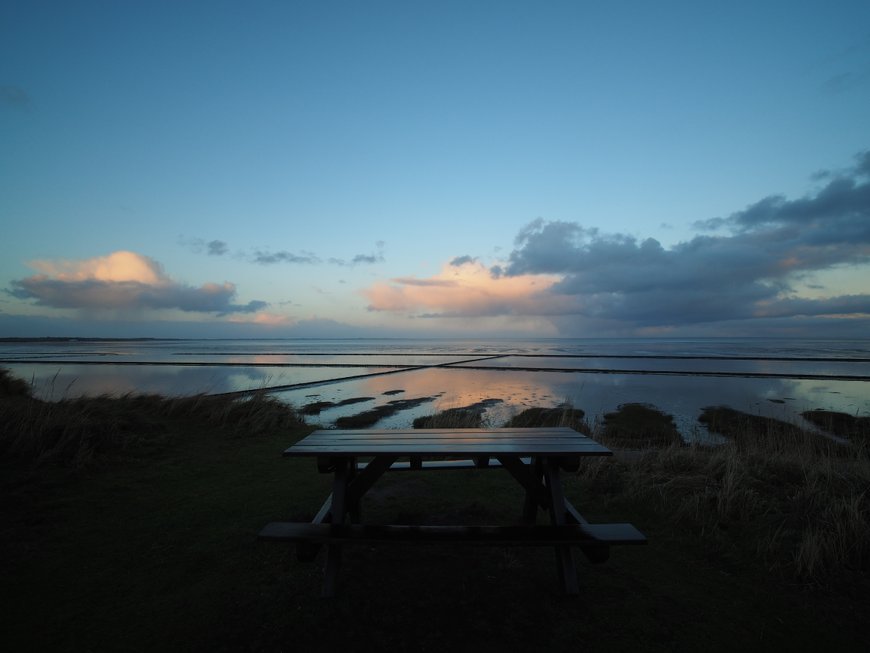
The Wadden Sea stretches 500 kilometres along the North Sea coast between Den Helder in the Netherlands and Blåvandshuk in Denmark, covering roughly 11,500 square kilometres of intertidal mudflat that UNESCO inscribed as a World Heritage Site in 2009. The German section accounts for about 450 kilometres of coast and hosts roughly 12 million migratory birds each year, ranking this stretch of shallow sea among the most biologically productive ecosystems in Europe. This guide covers mudflat walking (Wattwanderung) with certified guides, the seven East Frisian Islands that form the seaward barrier, the two German national parks, base towns for day trips, wildlife and tidal timing, and the safety rules that govern any walk onto the exposed seabed.
What the Wadden Sea Is and How It Formed
The Wadden Sea is a vast system of tidal flats, channels, sandbanks, and salt marshes that form where the North Sea meets the continental shelf. Twice each day the tide exposes mudflat areas large enough to walk across, then floods them again with water up to three or four metres deep. The constant exchange between sea and land drives the productivity of the ecosystem.
The formation dates to the post-glacial rise in sea level around 7,000 years ago, when rising waters flooded the low-lying coastal plain of northern Europe. Rivers carrying sediment from the European interior deposited clay, silt, and sand in the shallow margins, and waves reshaped those deposits into the barrier islands and intertidal flats visible today.
UNESCO inscribed the Dutch and German Wadden Sea as a World Heritage Site in 2009 under natural criteria for biological and geological significance. The Danish section followed in 2014, making this the largest cross-border World Heritage nature site in Europe.
Wattwanderung: How Mudflat Walking Works
Wattwanderung is the German term for guided walks across the exposed mudflat at low tide. The practice developed from the traditional knowledge of coastal communities who used the seabed at low tide as a walking route between mainland and islands before regular ferry services.
A typical guided walk lasts 90 minutes to three hours depending on the route. Participants wear shorts or rolled trousers, walk barefoot on the mud, and follow a certified guide (staatlich gepruefter Wattfuhrer) who reads tide charts, weather patterns, and local channel conditions. The mud itself is firm in most places with soft patches around creek beds, producing a walking sensation somewhere between wet sand and clay.
Walks fall into several formats:
- Short introductory walks: 90 minutes, stay close to the base town, suitable for children and first-timers
- Island crossings: 3 to 4 hours, walk from mainland to an island such as Amrum or from one island to another
- Specialist wildlife walks: focus on seal colonies, bird ringing stations, or tidal ecology
- Night walks and full-moon walks: rarer, booked months ahead, atmospheric rather than educational
Cost runs 8 to 15 euros per adult for standard walks, higher for specialist or multi-hour options. Children typically pay half price, and groups larger than 12 usually need private guide booking.
Schleswig-Holstein and Lower Saxony National Parks
The German Wadden Sea splits into two national parks that border each other at the Elbe estuary. Schleswig-Holsteinisches Wattenmeer Nationalpark covers the northern section from the Danish border to the Elbe, about 4,410 square kilometres. Niedersachsisches Wattenmeer Nationalpark covers the Lower Saxony section south of the Elbe, about 3,450 square kilometres, including the seven East Frisian Islands.
Both parks operate under German federal nature-protection law, with zoning that restricts access in sensitive areas during breeding and moulting seasons. Core zones (Ruhezone I) allow almost no human activity. Buffer zones (Zwischenzone) permit guided walks along marked routes. Recreation zones (Erholungszone) accommodate swimming, beach use, and regular visitor activity near the main towns.
Permits are not required for visitors who join registered Wattwanderung tours or stay within the recreation zones. Independent walking off marked routes is prohibited, both for ecological protection and for human safety given the tidal risk.
The Seven East Frisian Islands
The East Frisian Islands form the seaward edge of the Lower Saxony Wadden Sea, running parallel to the coast from the Dutch border to the Jade Bay. Each has a distinct character, transport pattern, and tourism profile.
- Borkum: the largest and westernmost, 31 square kilometres, reached by ferry from Emden (1 hour) or Eemshaven in the Netherlands
- Juist: a narrow 17-kilometre island with no cars permitted, reached by ferry from Norddeich (80 minutes)
- Norderney: the second-largest at 26 square kilometres, the most developed for tourism, with its own spa tradition dating to 1797
- Baltrum: the smallest inhabited island at 6.5 square kilometres, around 500 residents, no cars
- Langeoog: 20 square kilometres of dunes and wide beaches, reached by ferry from Bensersiel, no cars
- Spiekeroog: the most car-free of the group, known for horse-drawn carriages and conservation focus
- Wangerooge: the easternmost, 8 square kilometres, reached by ferry from Harlesiel with a mandatory small train transfer on arrival
Five of the seven islands ban private cars entirely. Visitors travel on foot, by bicycle, or in the case of Spiekeroog by horse-drawn cart. The car-free rule shapes the pace of island life and makes the islands especially popular with families and older travellers seeking quiet.
Wildlife: Birds, Seals, and Tidal Biology
The Wadden Sea supports roughly 10,000 species, though the number that catches attention is 12 million: the annual count of migratory birds using this coast as a staging area on the East Atlantic Flyway. Dunlins, red knots, bar-tailed godwits, brent geese, and common eiders all feed on the mudflat invertebrates during spring and autumn passage.
Seal populations have recovered significantly since the viral outbreak of 1988 and 2002 that temporarily collapsed the numbers. Current population estimates put common seals at around 40,000 and grey seals at around 7,500 across the trilateral Wadden Sea. Seal sandbanks near Spiekeroog, Norderney, and the Amrum-Sylt area allow boat-based viewing during low tide.
Harbour porpoises and the occasional grey seal pup mix with more common species. Below the surface, lugworms, cockles, mussels, and shrimp form the base of the food chain that supports the bird and mammal populations above.
Bird ringing stations at Wilhelmshaven, Norderney, and the Danish islands track populations and migration patterns. Visitors can sometimes observe ringing work during open mornings, typically requiring advance booking through the park visitor centres.
Best Season and Tidal Timing
The mudflat walking season runs roughly from March through October. April and May bring spring bird migration, June and July add seals and favourable weather, August and September offer warmest water temperatures, and October produces autumn migration spectacles that match the spring event.
Winter walks exist but require serious cold-weather gear and experienced guides. The mud cools dramatically from November onwards, and walking barefoot becomes impractical. Most commercial operators suspend walks between late October and early March.
Tidal timing matters more than weather. The tidal range across the German Wadden Sea averages 1.5 to 3.5 metres depending on location, with a full tidal cycle about 12 hours 25 minutes. Walks usually start two to three hours before low tide and return within two hours after. Tide tables (Gezeitenkalender) published by local tourism offices and the Bundesamt fur Seeschifffahrt are the authoritative source for timing.
Never attempt an unguided walk without consulting tide tables. The water returns rapidly across the mudflat, and people trapped by rising tide rarely reach safety without rescue.
Base Towns for Day Trips and Overnights
Four mainland towns serve as the main access points for Wadden Sea walks and island ferries. Each has a distinct character and transport connection.
Cuxhaven sits at the mouth of the Elbe, one of the largest and best-connected base towns. Trains run from Hamburg in about two hours. The town has a long pier, a maritime museum, and several certified Wattfuhrer offering daily walks. The ferry to Heligoland (Helgoland) also departs from here.
Busum on the Schleswig-Holstein coast offers quieter tourism, a protected harbour, and easy access to walks around the Eiderstedt peninsula. Trains from Hamburg via Husum take about three hours.
Norddeich on the Lower Saxony coast is the main ferry terminal for Norderney and Juist. Trains run from Hanover via Emden in about three hours. The town itself is small but functional, with walking tours and ferry connections structured around the tide.
Wilhelmshaven on the Jade Bay offers the deepest harbour on the German North Sea coast and serves as the ferry port for Wangerooge plus the seal sanctuary (Seehundstation) at Norddeich. The town’s Wilhelmshavener Wattenmeer house serves as a park visitor centre.
Safety Rules and What to Bring
German law requires that all Wattwanderung participants outside the recreation zone walk with a certified guide. The Wattfuhrer qualification takes several years of training and covers tide reading, weather forecasting, channel navigation, first aid, and ecological interpretation. Groups typically cap at 20 people per guide for safety.
What to wear depends on weather but the basics stay consistent. Shorts or quick-drying trousers that you do not mind getting muddy. Long socks or neoprene wader socks if the mud is cold (common in April and October). A windproof jacket even on sunny days because the wind off the sea can be sharp. A hat with a chin strap because the wind takes loose headwear quickly. Sunscreen and sunglasses because reflection off wet mud raises UV exposure.
What to bring in a daypack. Drinking water, a snack, spare socks for after the walk, a waterproof phone case, and a small towel. Leave cameras in splash-proof cases or avoid expensive gear entirely, since a fall into a channel can be sudden.
What to avoid. Walking with a young child carried on shoulders (risk in case of a fall). Ignoring the guide’s pace signals. Leaving the marked group to photograph something. Trying to cross channels or creeks that the guide has not confirmed are passable.
Frisian Language and Cultural Heritage
The communities along the Wadden Sea coast maintain a distinct cultural identity linked to centuries of seafaring, fishing, and land reclamation from the sea. West Frisian, East Frisian, and North Frisian languages survive in fragments across the region, with North Frisian still spoken by around 10,000 people on the islands of Sylt, Amrum, and Fohr.
Traditional livelihoods shaped the landscape. The Halligen, tiny inhabited islands in Schleswig-Holstein’s Wadden Sea, sit on raised mounds called Warften that lift the houses above storm tides. Residents historically worked mudflat and salt marsh, raising sheep on the meagre grass and salvaging from the sea. Several Halligen remain inhabited today, though tourism has replaced agriculture as the main income source.
Regional food traditions draw heavily on the sea. Matjes herring, North Sea shrimp (Krabben), and mussels appear on nearly every coastal menu. Tea culture runs strong in East Frisia, where a formal tea ceremony with rock candy and cream predates English tea customs and survives in island cafes and private homes.
Frequently Asked Questions
Is Wattwanderung dangerous?
With a certified guide, the risk is very low. Accidents almost always involve unguided walkers who misjudge the tide or the weather. The tidal return is rapid once it starts, and the mudflat offers no high ground for refuge. Book through the park visitor centres or tourist information offices.
Can I walk from the mainland to an island?
Yes, on guided crossings only. The most common route is mainland to Neuwerk island near Cuxhaven, a three-hour walk with a guide. Crossings to other islands operate in limited seasons and weather windows. Never attempt an island crossing without a qualified guide.
What about the Halligen islands?
The Halligen are the small inhabited mud islands in Schleswig-Holstein’s Wadden Sea. Several have ferry services from Schluttsiel and other mainland ports. Overnight stays on Halligen such as Hooge or Langeness offer a distinctive experience, with houses set on raised mounds and the sea covering the low land during storm tides.
When is the best time to see seals?
June through August offers peak seal viewing because pups are on the sandbanks with their mothers. Boat trips from Wilhelmshaven, Norderney, and Amrum visit the seal sandbanks at low tide. The Seehundstation Norddeich rehabilitates orphaned pups and allows public viewing year-round.
Is the Wadden Sea suitable for children?
Yes, short introductory walks are well-suited to children aged five and older who can handle 90 minutes of walking. Several operators run family-focused walks with nature games and short distances. Children under five may struggle with the mud texture and walking pace.
How do I get from Berlin or Munich to the Wadden Sea coast?
From Berlin or Munich, the most efficient routes run by ICE train to Hamburg first, then regional trains to Cuxhaven, Husum, or Norddeich. The full journey takes five to eight hours depending on connections. Flying to Hamburg, Bremen, or Hannover cuts the travel time by a few hours and links to the same regional rail network.
For themed German route trips that pair with the Wadden Sea, see our German Fairy Tale Road guide, which ends in Bremen only 90 minutes south of the Lower Saxony coast. Another Berlin-accessible nature area appears in our Spreewald travel guide.
Sources and Further Reading
- UNESCO World Heritage Centre, Wadden Sea inscription documentation
- Common Wadden Sea Secretariat, Trilateral Wadden Sea Cooperation reports
- Nationalparkverwaltung Niedersachsisches Wattenmeer, park visitor information
- Nationalparkverwaltung Schleswig-Holsteinisches Wattenmeer, educational materials
- Bundesamt fur Seeschifffahrt und Hydrographie, tidal calendar publications
- Hero photograph: Wattenmeer 14 by Mario Kepinski, Wikimedia Commons, CC BY-SA 4.0